


Our stories
Seeing the whole picture
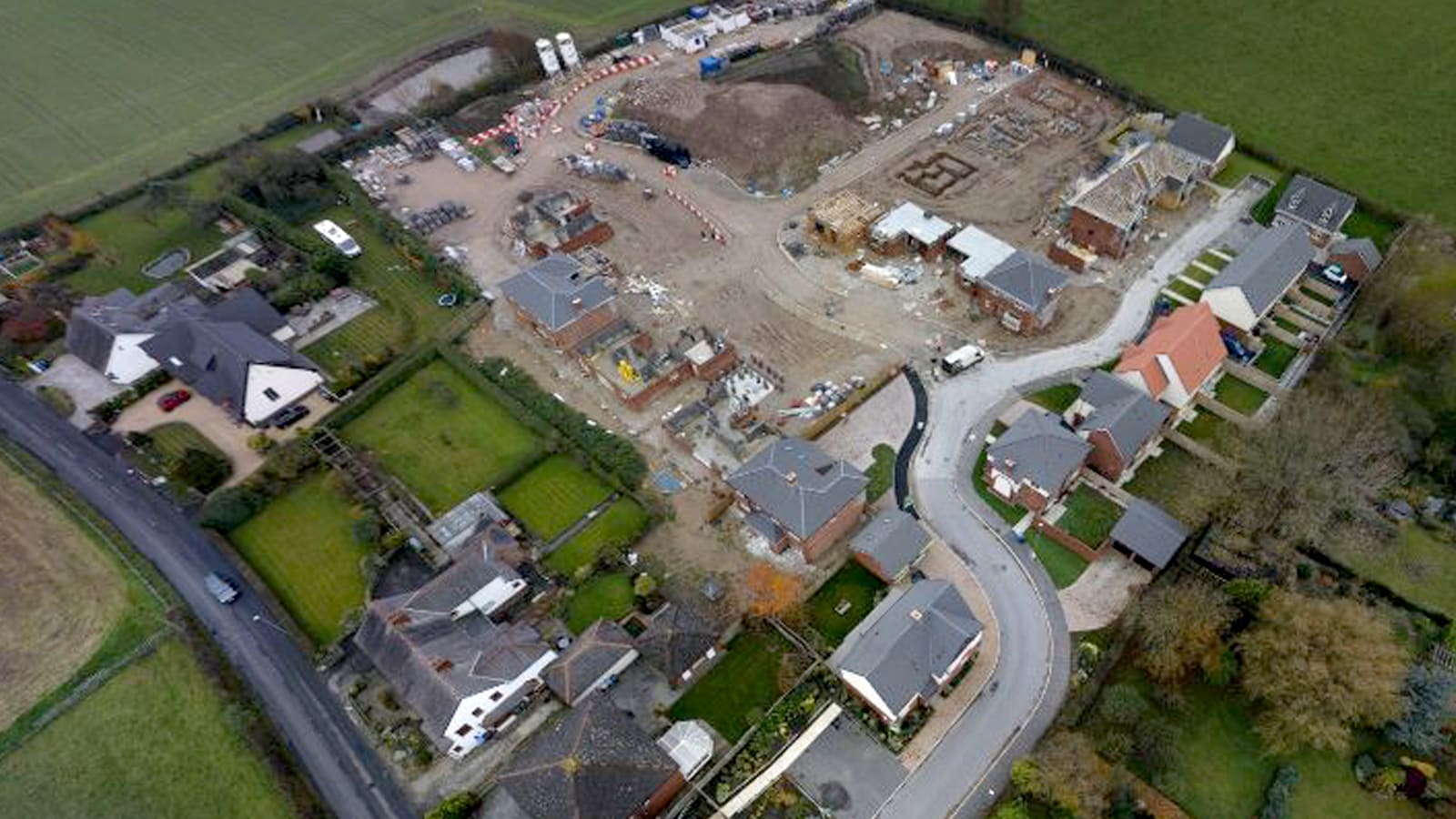
Our Real Estate and Drones teams worked together to visualise buildings at multiple locations in the early stages of an administration, saving time and money.
Setting the scene
How do you inspect properties quickly without ever actually visiting them?
This was the challenge posed to our Business Restructuring Services’ Real Estate team, which urgently needed to get the full picture of the properties it was taking control of as part of an administration.
We needed a way to assess the assets quickly, identifying the most appropriate strategy across a portfolio to preserve value in the early stages of the work. We also needed to understand where there may be retention of title claims.
We quickly identified a nimble, efficient and tech-enabled solution: drones. Using drones, our team could easily share the captured intuitive imagery with all stakeholders and revisit the sites throughout the administration.
How we helped
In collaboration with our in-house Drones team and its partners, our Real Estate team conducted virtual visits to six sites that we were managing as part of an administration in the north-west of England.
Despite the subject matter experts being based in London, the high-resolution images taken by the drones and the intuitive, cloud visualisation platform allowed our surveyors to rapidly build an understanding of the properties.
The team could identify issues that needed immediate attention, ensuring the sites were secure and adhering to health and safety considerations - all of which preserved value. We also generated measureable top-down maps and aerial images (orthophotos) that allowed for comparison with Land Registry title plans, a 360-degree walk-through of the sites and assessment of the surrounding areas.
The drone data helped us discuss the assets with our agents and assisted with the disposal processes. The data also allowed us to have better-informed asset management and disposal discussions about the properties with our client and agents.
Multiple users across the wider insolvency team could also remotely view the sites, and potential buyers could inspect them without actually being there, reducing delays in the sale of some of the assets.

“Using their drone technology PwC have come up with a highly effective solution to allow properties to be inspected remotely. This innovation affords significant time savings for all parties involved in property management, plus the ability to share the information instantly with other stakeholders is of huge benefit. We wholeheartedly recommend this approach to anyone needing to understand the individual features of a property in circumstances where a physical inspection isn’t possible.”
Making a difference
The drone data helped inform crucial strategic decisions across the portfolio, including identifying a potential break-in at one property, informing the response to a waste management emergency at a residential development site, and enabling the inspection of a secured building.
We used cloud visualisation throughout the administration to develop property strategies, identify asset management initiatives, market the assets and provide detailed updates to the creditors. This made the administration more efficient and generated significant cost savings to the benefit of creditors.
This innovative use of drones has been a differentiator since this initial project. Since then, we’ve shown a number of clients the potential benefits of using drones to carry out surveys and how we can support them to do this.
We’ve now presented the case study in market training for three different banking groups, as well as in multiple proposals, receiving plenty of positive feedback from clients.
Contact us


