


A progress update of this case study is now available, but we recommend reading this original version (from 2022) first for important background and context.
Read the progress update Read the full report
The UK has seen a number of major flooding events in recent years, with both changes in climate and the built environment having a large impact on the floods that we see. February 2020 was the wettest on record in England and the Intergovernmental Panel on Climate Change says ‘once-a-century’ sea level events will occur annually by 2050. The economic losses from the winter 2019/20 flooding are estimated to be about £333 million, however flood prevention measures are thought to have avoided economic damage of at least 14 times this amount (refer to National Flood and Coastal Erosion Risk Management Strategy for England). Despite new flood defences, flooding cannot be stopped completely, and it is therefore important that it is dealt with effectively when it occurs.
Drone technology can assist here, providing a number of benefits in the immediate aftermath of a flood. It is vital that action is taken quickly, to enable informed decision making, minimise disruptions and in more severe cases, save lives. The unique aerial perspective that drones offer is particularly useful. Through streamed video and photogrammetric processing of images, drones can quickly and easily highlight the extent and magnitude of flooding using the data that they collect. This information can be utilised by a number of stakeholders, from first responders on the ground to insurance companies.
Depending on the sensor that is attached to the drone, they can also be used for a variety of other purposes. Search and rescue teams can utilise drones with thermal imagery cameras to identify individuals who may be stuck inside their homes or other hard to reach places. Communications providers can also put drones in the air to act as temporary cell towers, removing network downtime whilst key infrastructure is brought back online and allowing those in the area to coordinate response efforts.
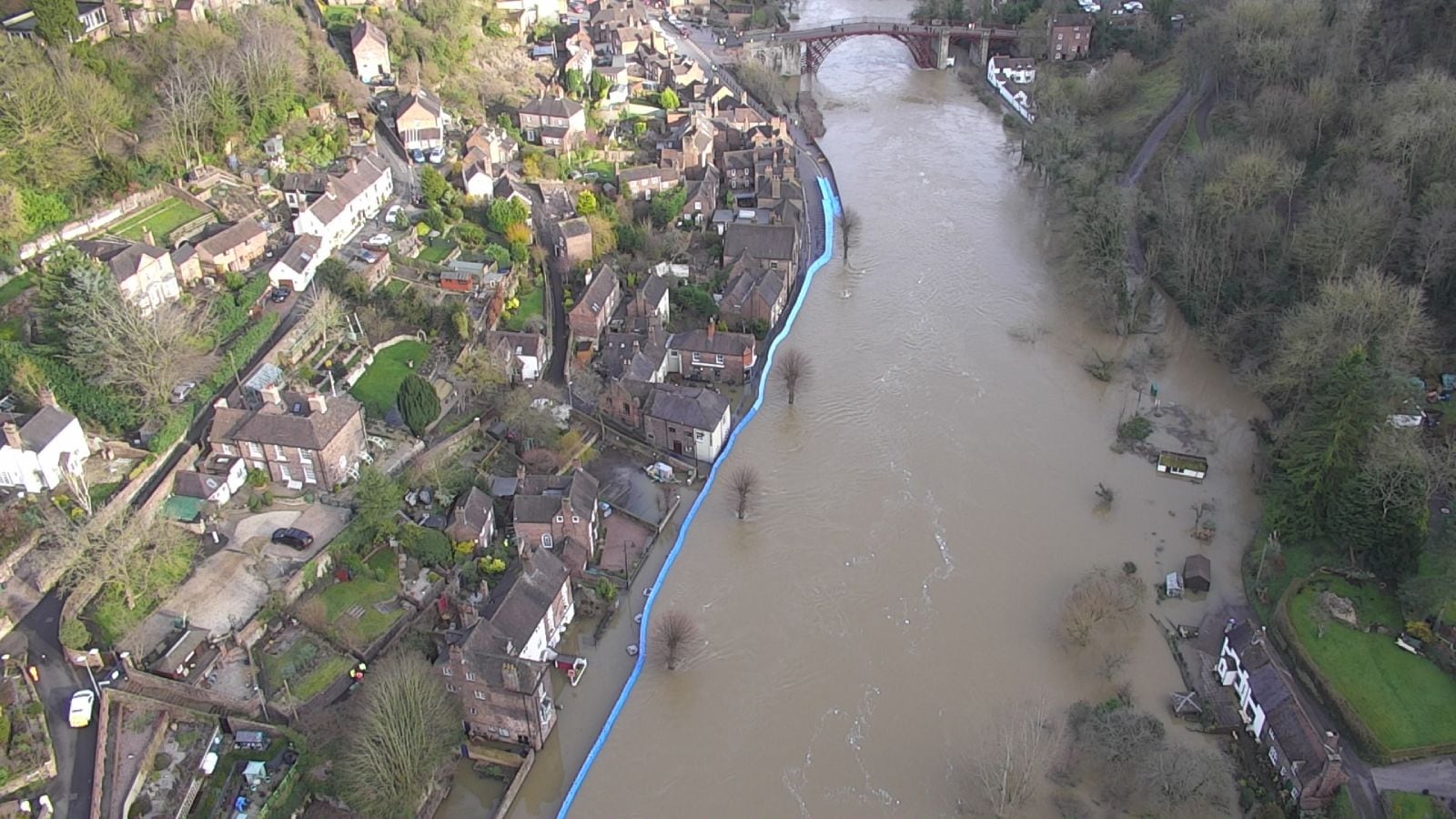
The Environment Agency (EA) is very aware of the need to act quickly in the aftermath of a flood. They have a 24/7, 365 days per year drone response service, which aims to mobilise and stream a live video feed within six hours of an incident. In the past, these live images have been used in incident control rooms and meetings to assess the impact of flooding and give insight to key decision makers. Drones play a critical role in the coordination of a more efficient response to flooding, illustrating their significant value in a non-commercial environment. The EA currently outsources these drone operations to RUAS, who has a large fleet of drones which can be operated simultaneously from three different geographical locations during and after environmental incidents.
“Presenting to senior emergency management staff our live drone footage of the temporary barriers at Ironbridge helped to sustain our credibility as a competent operator of choice and bolster their own confidence through observing what was actually happening rather than listening to what others thought was happening.”
Environment Agency
Drone data can also be used to shape flood defences and as a key input into the planning and modelling of various scenarios. In the future, we anticipate that drones will function as an integrated part of a real-time flood modelling and response solution, combining AI, predictive models, IoT sensors and big data to optimise flood responses. The drone data could be captured by autonomous Drone-in-a-box solutions which are strategically placed around the UK and able to fly Routine BVLOS (beyond visual line of sight) with little or no pilot involvement. Flights from these drones would be triggered routinely or in response to the predictive flood model (incorporating big data) and/ or IoT sensor alerts. Such a solution should be better for the environment, be able to respond more quickly, improve communications and ultimately reduce the cost and environmental impact of floods.

This case study is an extract from the report
Skies Without Limits v2.0