


A progress update of this case study is now available, but we recommend reading this original version (from 2022) first for important background and context.
Read the progress update Read the full report
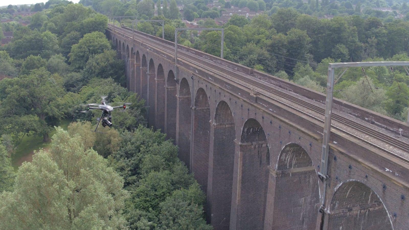
The inspection and survey of railways plays a key role in the safety of the millions of people who use the UK rail network every day. There are high standards to adhere to in everything from inspections to measuring how close trees are to the track. The challenge is how to carry out these tasks effectively without causing disruption and delays to the overall service.
Drones are certainly one of the answers, meeting many of the requirements of “traditional” inspection and survey methods but, unlike many traditional approaches, without a need to stop trains running or walk the track. Drone operations are also safer, faster and require fewer people, dramatically reducing the hours of staff exposure to risk.
Drone surveys can deliver precise models and one company, Plowman Craven, has achieved a very high degree of accuracy for rail applications. Their solution delivers +/- 5mm absolute accuracy and meets Network Rail’s “Band 1” accuracy requirement. This allows Plowman Craven to carry out track alignment assessments with their drone (the Vogel R3D), all whilst staying 25m above the track, out of the way of the trains and without compromising accuracy.
“Safety is of paramount importance and is driven by Network Rail’s own “boots-off-ballast” approach. The Vogel R3D system virtually eliminates track access, but in doing so also provides a significant reduction in programme time. A typical 6-week lead time for track possession can be avoided, leading to faster project deployment and completion, with the associated reduction in risk and cost.
Where the Vogel R3D differentiates itself is the degree of accuracy obtained from the system. The robust survey workflows and latest technology combine to provide what is claimed to be one of the world’s most accurate UAV Survey Systems. In fact, the system is being developed further to enable visual inspection of switches and crossings. Tolerances for this type of work go far beyond Band 1 accuracy, with some activity requiring +/- 1mm accuracy.
Solving problems such as this opens up further opportunities with machine learning. The ultra-high resolution images provide the perfect starting point for software algorithms to do the hard work of identifying features, issues, missing P-Way, cracks and wear. Track engineers can then focus their skills on identified areas of concern rather than walking miles of track in the dark.
One of Network Rail’s Senior Engineers states: “The application of the Vogel R3D system is a real game-changer for Network Rail and helps us to satisfy many of our survey requirements in a safe manner without the cost implications or potential programme delays associated with multiple possessions.”
Plowman Craven
Network Rail has been an early adopter of drone technology and has a well-staffed pilot roster, several relationships with drone service providers and an end-to-end drone workflow. Moving forward, Network Rail is keen to increase the efficiency of drone solutions by using Routine BVLOS (beyond visual line of sight) drone flights to, for example, measure vegetation encroachment. They have already begun conducting BVLOS trials, completing a 25km drone flight over tracks in Oxfordshire at the end of October 2021.


This case study is an extract from the report
Skies Without Limits v2.0